")
")


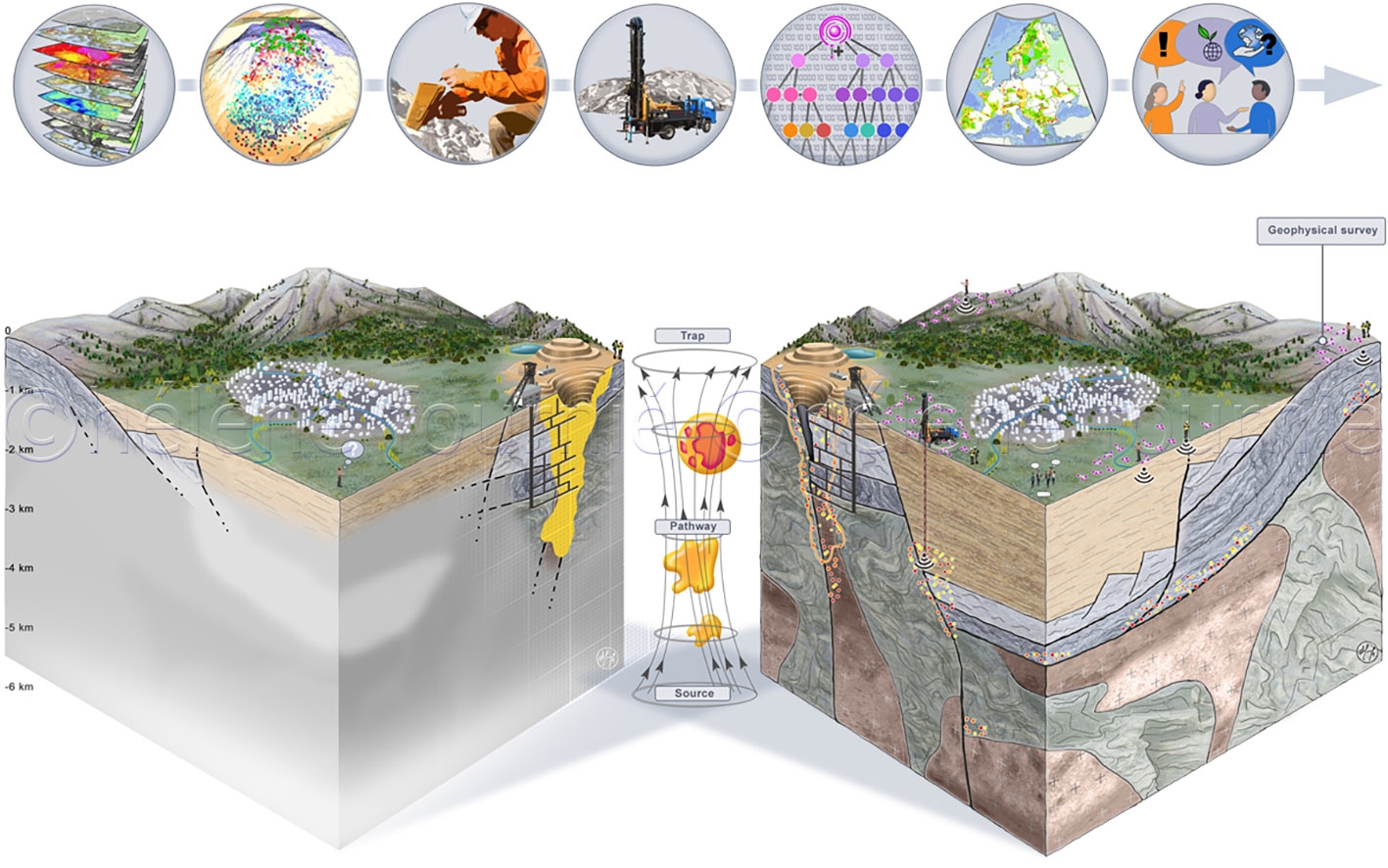
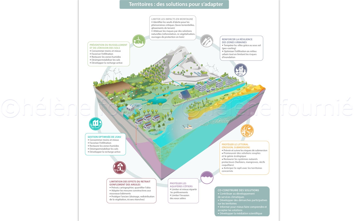
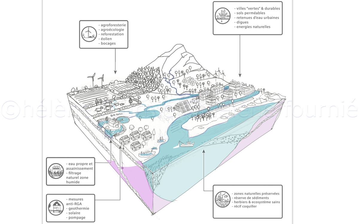
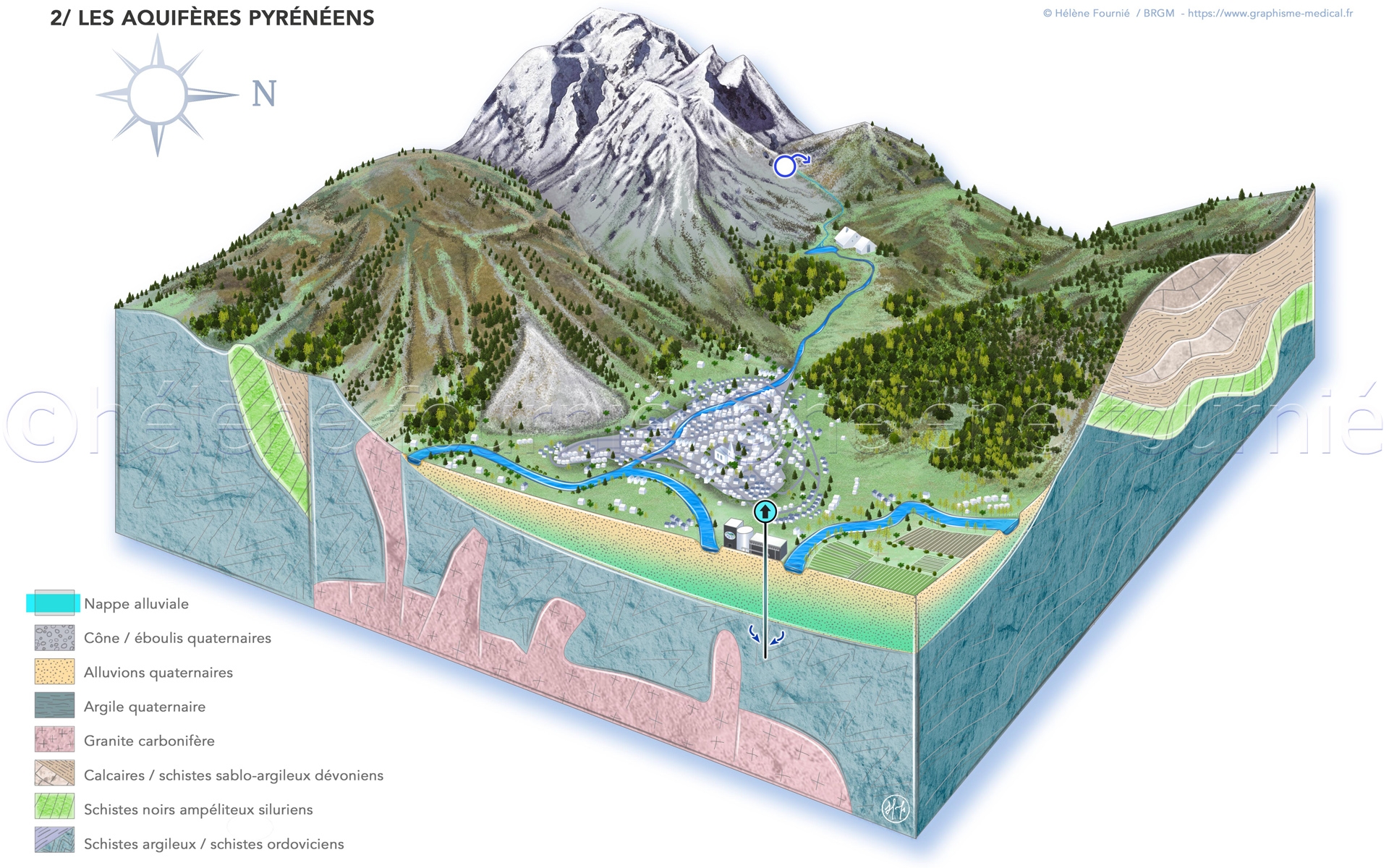
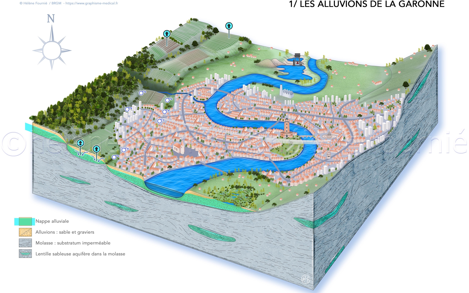
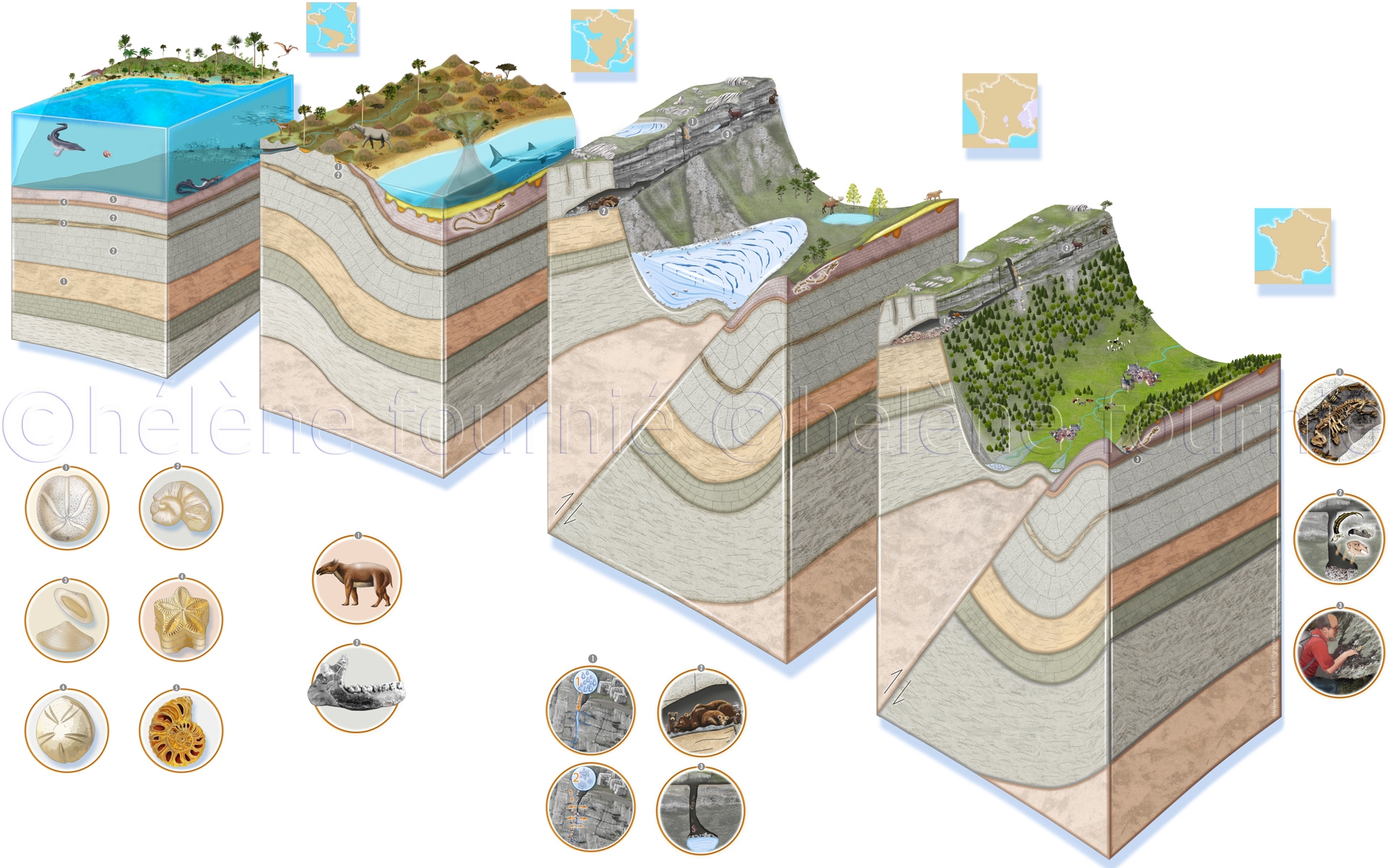
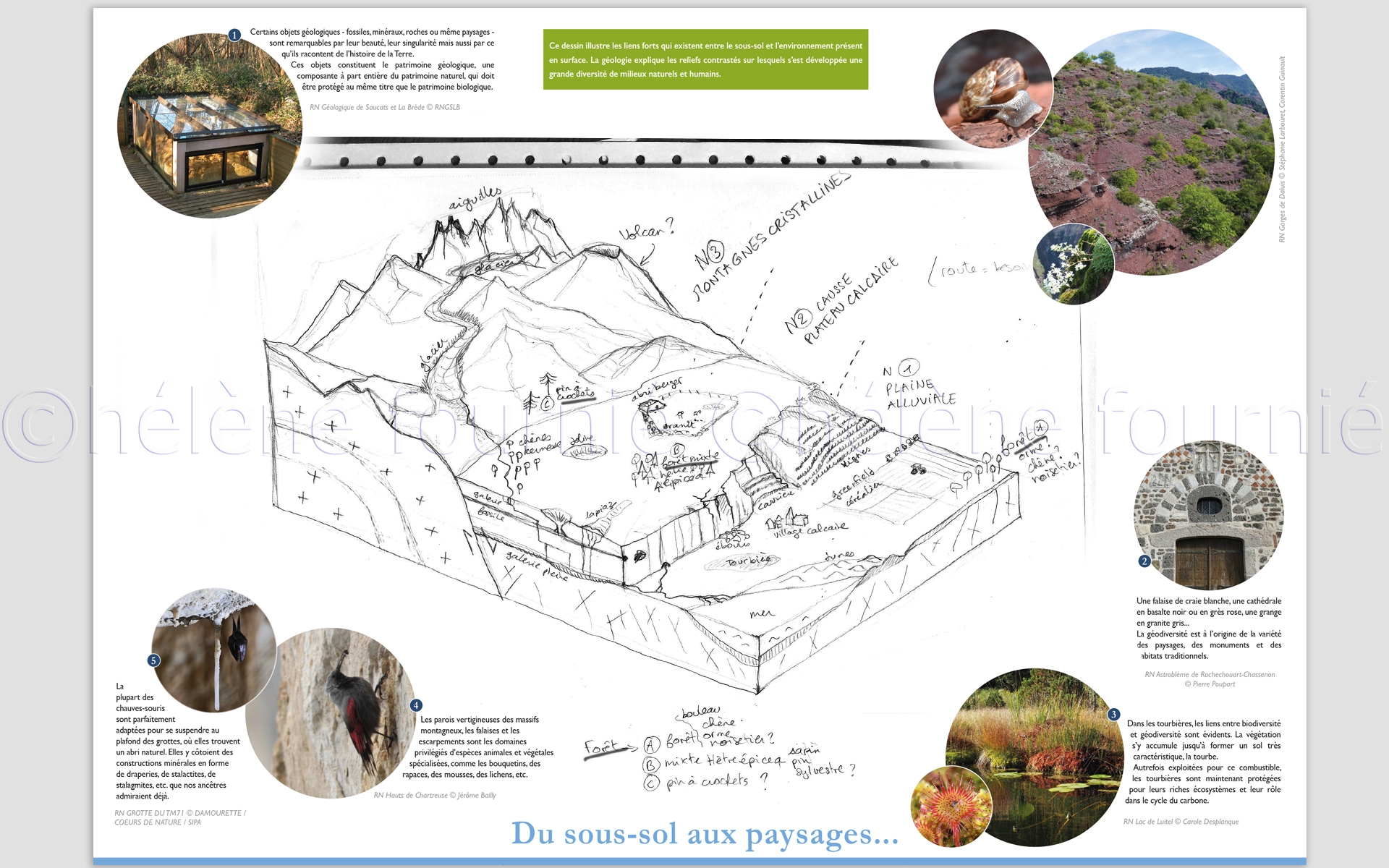
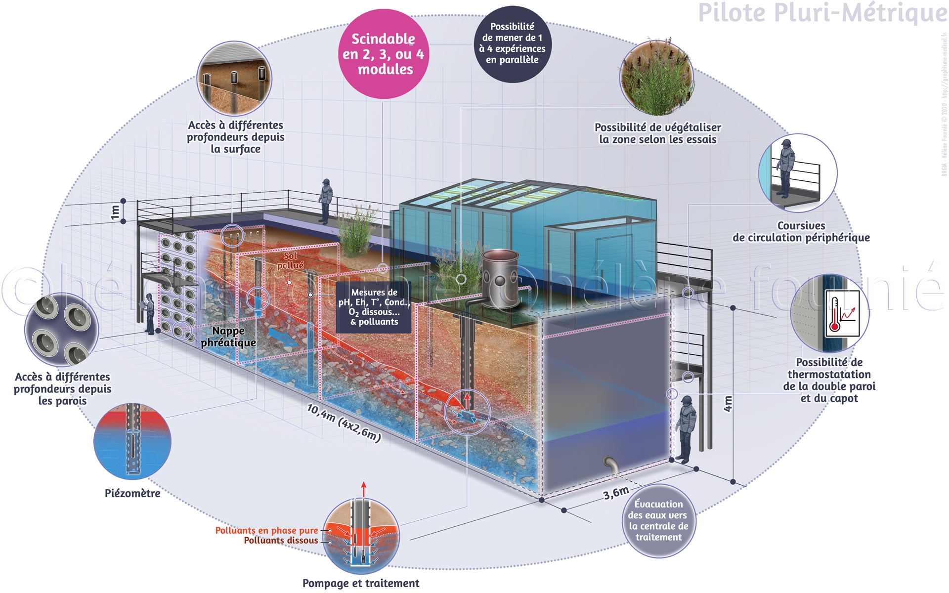
BRGM, Bureau de Recherches Géologiques et Minières, is the French public institution of reference in the application of earth sciences to manage the resources and risks of the soil and subsoil.
This establishment called on Hélène Fournié to produce 2 illustrations of hydrogeological synthesis of the Haute-Garonne, which had to be a compromise between exact scientific information and vulgarisation. The first block diagram represents the alluvial water table of the Garonne over the centuries, with a schematic representation of its meanders, alluvial terraces, molasse formations and springs, as well as an urban design to identify the city of Toulouse. The second represents the different types of aquifers in the Pyrenees and the use of groundwater in the Pique valley.